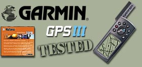
Garmin
GPSIII Plus
 One
of the greatest things about the GPSIII Plus is how easy it
is to get around and make changes. All of the changes are done
through menus. From any page, you can press the MENU button.
Simply make selections from lists using the thumb button and
the ENTER button. The QUIT button always takes you back out
to the main screens.
One
of the greatest things about the GPSIII Plus is how easy it
is to get around and make changes. All of the changes are done
through menus. From any page, you can press the MENU button.
Simply make selections from lists using the thumb button and
the ENTER button. The QUIT button always takes you back out
to the main screens.
When
using the GPSIII Plus, it is extremely easy to set new waypoints.
Simply press the ENTER key to mark a coordinate. You can then
give the waypoint a short alphanumeric name and even give it
an icon from a large on-board list. Later, when you want to
find a waypoint, simply press the GOTO button and select the
waypoint from the list.
Another
very useful feature of the GPSIII Plus is spell 'n find. Say
you are in Colorado somewhere and you want to go to Moab, Utah.
Simple! Using spell 'n find, you can enter MOAB and tell the
GPS to guide you there. Easy!
You
can also ask the GPS to tell you the nearest 50 cities, 9 nearest
waypoints, and the closest 50 exits. Like spell 'n find, you
simply tell the Garmin to take you there and follow the clues.
Believe
it or not, that's just the nutshell version of what the GPSIII
Plus will do. Though the screen may be a bit small for some
eyes, it helps make a very compact unit that fits very well
on your dash or even on a bicycle. Please do not try to drive
and operate the GPS at the same time. The GPSIII Plus usually
runs a little under $400 on the street and is worth every penny.
But
wait! There's more! MapSource CD's
 If
you're really looking to beef up your GPSIII Plus beyond it's
stock capabilites, consider buying into the MapSource CD collection.
These CD's run on your PC and can be used on their own or in
conjunction with the GPSIII Plus and several other Garmin GPS
models. CD's include United States TOPO, United States Waterways
& Lights, Roads & Recreation (includes county &
residential roads for all of the US), and WorldMap (extends
the basemap to include more countries). Our sample was sent
to us with United States TOPO.
If
you're really looking to beef up your GPSIII Plus beyond it's
stock capabilites, consider buying into the MapSource CD collection.
These CD's run on your PC and can be used on their own or in
conjunction with the GPSIII Plus and several other Garmin GPS
models. CD's include United States TOPO, United States Waterways
& Lights, Roads & Recreation (includes county &
residential roads for all of the US), and WorldMap (extends
the basemap to include more countries). Our sample was sent
to us with United States TOPO.
The
MapSource TOPO maps are similar to US Geological Survey 1:100,000
scale paper maps. The software allows you to find and transfer
waypoints, routes and tracks from your PC to your Garmin GPS.
You can find highways, roads, snowmobile trails, backwoods trails,
elevation contours, geographic names, churches, schools, waterways,
boat ramps, and much more. The CD lists for about $150.
Installation
is a snap. Simply insert the disc into your PC and follow the
instructions. Your GPSIII Plus will plug into the serial port
of the computer using an additional cable.
Though
we found MapSource to be fun and very useful, we did find ourselves
opting to not see all of the topo data when using our GPSIII
Plus. The topo information seemed to just clutter up the already
small screen, making it of very little use. However, for planning
a trip, it could be a nice tool. The Roads & Recreation
CD would have served us well, if we wanted the ability to add
smaller-sized roads during long excursions.
MapSource
Screenshots --->>>