 |
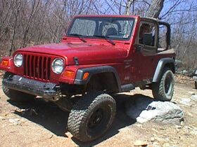
We
soon abandoned the barren strip-mine pits for a more natural setting
on the other side of the mountain that consisted of many rocks, streams,
and trees. Keep in mind, when I speak of a "mountain", it
is referring to what western rockcrawling folk would deem a large
hill that is densely vegetated. Paragon contains some fine examples
of these rolling hills that you can find in scenic Pennsylvania. They
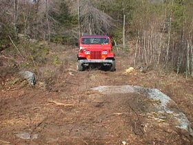
are a part of the Appalacian Mountain chain. The Jeep in this picture
is nearing the summit of the mountain now. |
 |
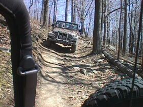
This
part of the trail is a tame connecting trail that I believe is called
"The Turtle Trail Bypass". There is a 15 yard rock-field
at the top of the actual "Turtle Trail" that would have
presented problems for the less-equipped vehicles. |
 |
"The
Turtle Trail" got its name a few years ago when a Turtle Truck
from one of the famous "Turtle Expeditions" painstakingly
ran the trail. The Turtle Trail, before it was named, was formerly
an ATV trail that crossed the mountainside. The trail was widened
later to facilitate 4x4s - hardly wide enough to fit a full-size Ford
F350 with a camper on the pickup bed, which was the Turtle truck.
Due to all of the large trees around, that experience was like fitting
a square peg in a round hole. It took an impressive four hours, and
thus the trail was named. |
 |
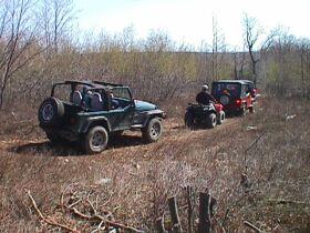
TJs
slowly descend the Turtle Trail after cresting the top of the mountain.
Through the whole length of the Turtle trail, there are patches of
obstacles that range in difficulty from novice to intermediate. It
is a great trail with ascents, descents, and rocks to really allow
one to get a feel of their vehicle's offroad ability - which is what
All American achieves by putting on this event. |
 |
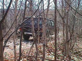
Jen
follows the rest of the convoy, carefully picking her way over rocks.
(insert obligatory jeep pose picture here) Every once in the while
on the Turtle Trail, you can find a patch of rocks. They're mostly
the kind that catch your diffs, as opposed to the fun kind of rocks! |
 |
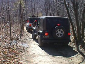
The
Turtle Trail is relatively long, and is used as a major artery, connecting
the strip-mine pit area of Paragon to a more wooded section on the
other side of the mountain. It is in this picture that the descent
into the woods is best displayed. The trees are more dense, and the
trail travels along a ridge in the woods. Before four-wheeling in
Paragon, it is a good idea to check to see if your braking system
is functioning properly. |
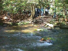 |
Finally,
we came to rest in the valley. People turned off their vehicles and
walked into the woods not far off the main trail to reveal a picturesque
stream that runs through Paragon. This stream is formed from others
that flow from collapsed mine shafts and runs from the top of the
mountain we had just descended. |