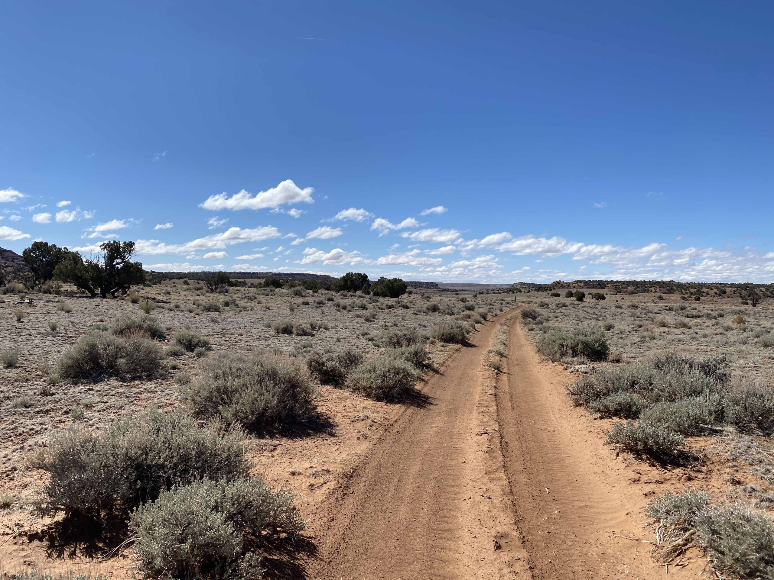
Overview: The Family Butte area, located within the San Rafael Swell, contains a network of trails that explore breathtaking cliffs and remote, desert landscape. Located within this network, BLM Route SS4121 stands out as a must-see for anyone looking to get off the beaten path and enjoy a remote, camping experience. This short spur leads off of BLM SS4115 to one of the most breathtaking dispersed campsite areas within the San Rafael Swell. Featuring multiple dispersed sites along the edge of a dramatic and vibrant red rock overlook, this is a destination you won’t want to miss. Located miles from the more popular routes in this area, your camping experience is sure to be one of silence and rugged beauty.
Getting There: SS4121 leads off of SS4115, just south of the main network of trails running across the Family Butte Mesa. There are two primary routes that lead to this area (though many others could be selected to fit you and your group within the many existing trails of the San Rafael Swell). For those looking for the most direct route along an easy, open road, we recommend traveling south along BLM Route SS4001 to SS4002 from I-70 (see picture below on the left). For those looking for a more scenic, exploratory route, we recommend taking Eagle Canyon from Justensen Flats to BLM Route SS4059 (see picture below on the right).
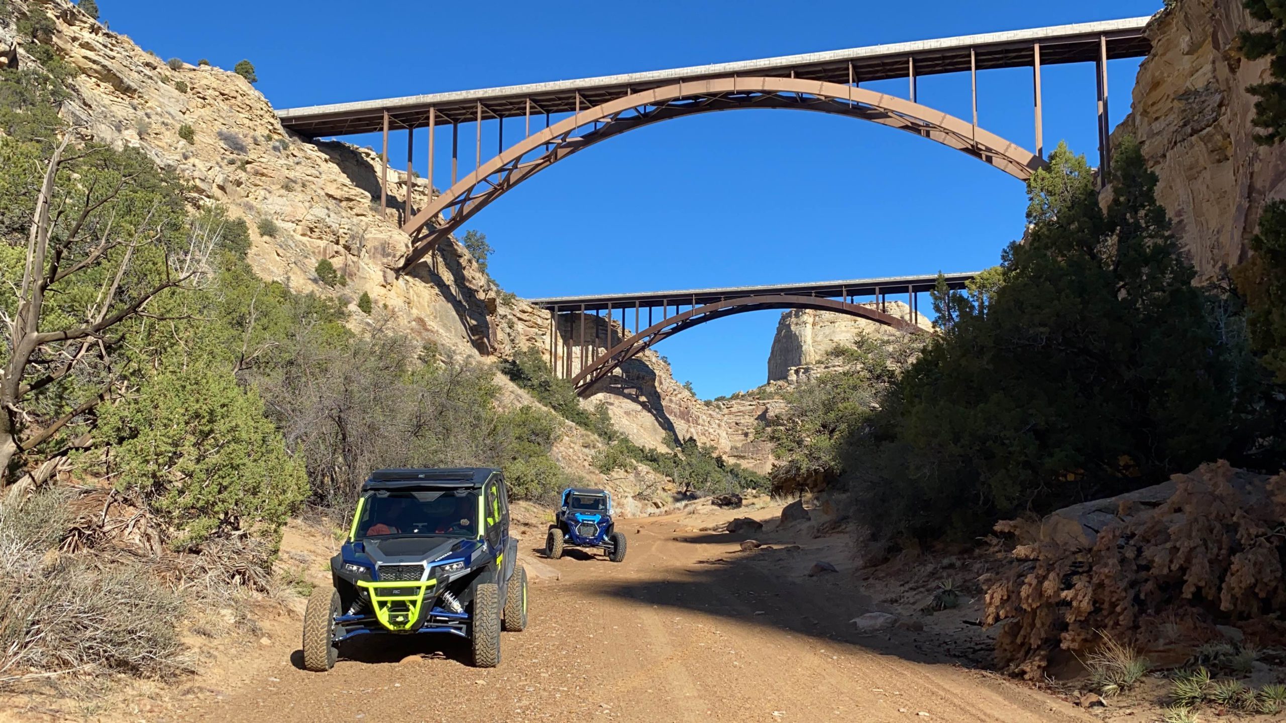
Route Conditions: BLM Route SS4002 is an easy, broad route, located adjacent to Family Butte Road. This route is passable for any high clearance, 4WD vehicle during most seasons of the year. Eagle Canyon to BLM route 4059 features more rugged, technical terrain and access to a plethora of routes and spurs located throughout the San Rafael Swell. We recommend using a well equipped, high clearance 4WD or AWD vehicle, should you take the second route.
Take time to familiarize yourself with the map and coordinates and plan a route that best fits you and your group. Be sure to not head off into the backcountry alone and tell someone where you are going before starting your trip. As always, utilize LEAVE NO TRACE practices. Irresponsible recreation leads to ecological damage, road closures, and loss of access to important resources. It is important that motorized users stay on the trail and camp within a 30′ buffer zone on either side of the road.
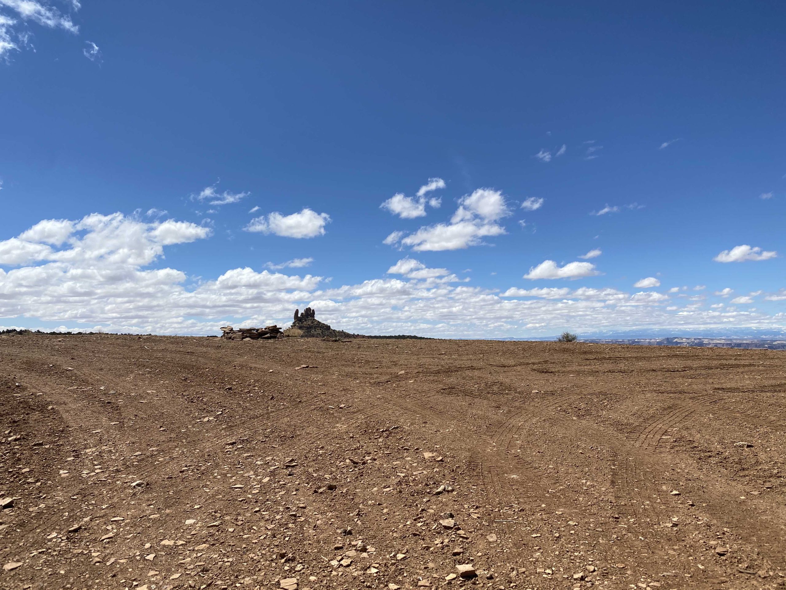

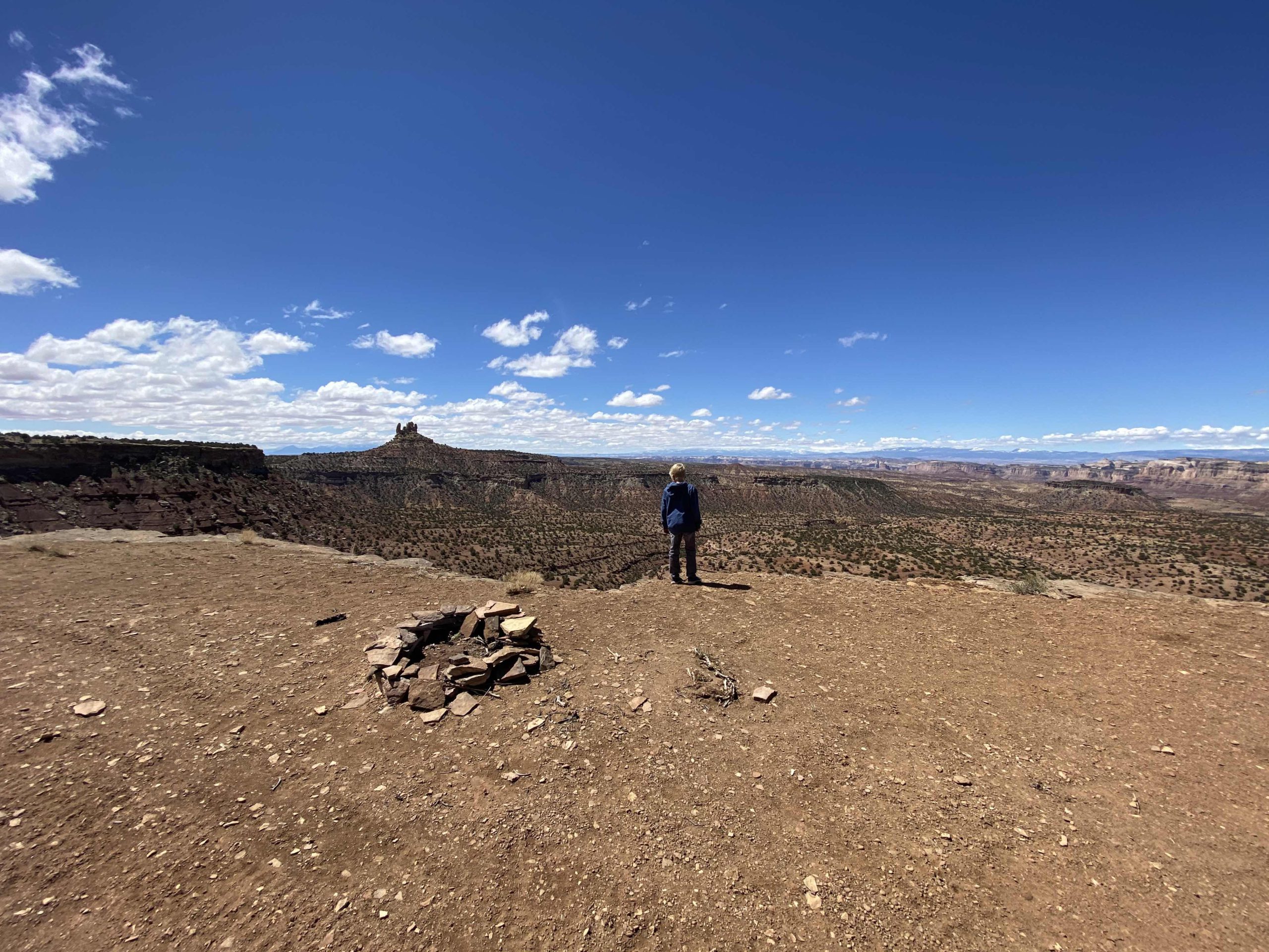
BLM Route SS4121 turns off from SS4115 at GPS coordinates 38°46’51.97″N and 110°50’36.17″W. The trail extends for approximately 0.05 miles before reaching the edge of a large drop off. The trail lines the edge of a vibrant overlook and is dotted with several spectacular dispersed campsites (as pictured above). This area contains five of the areas best dispersed campsites located within the San Rafael Swell. Due to the trail configuration, you can camp along the entire ridgeline. You will find these dispersed campsites at GPS coordinates 38°46’49.75″N and 110°50’34.74″W.


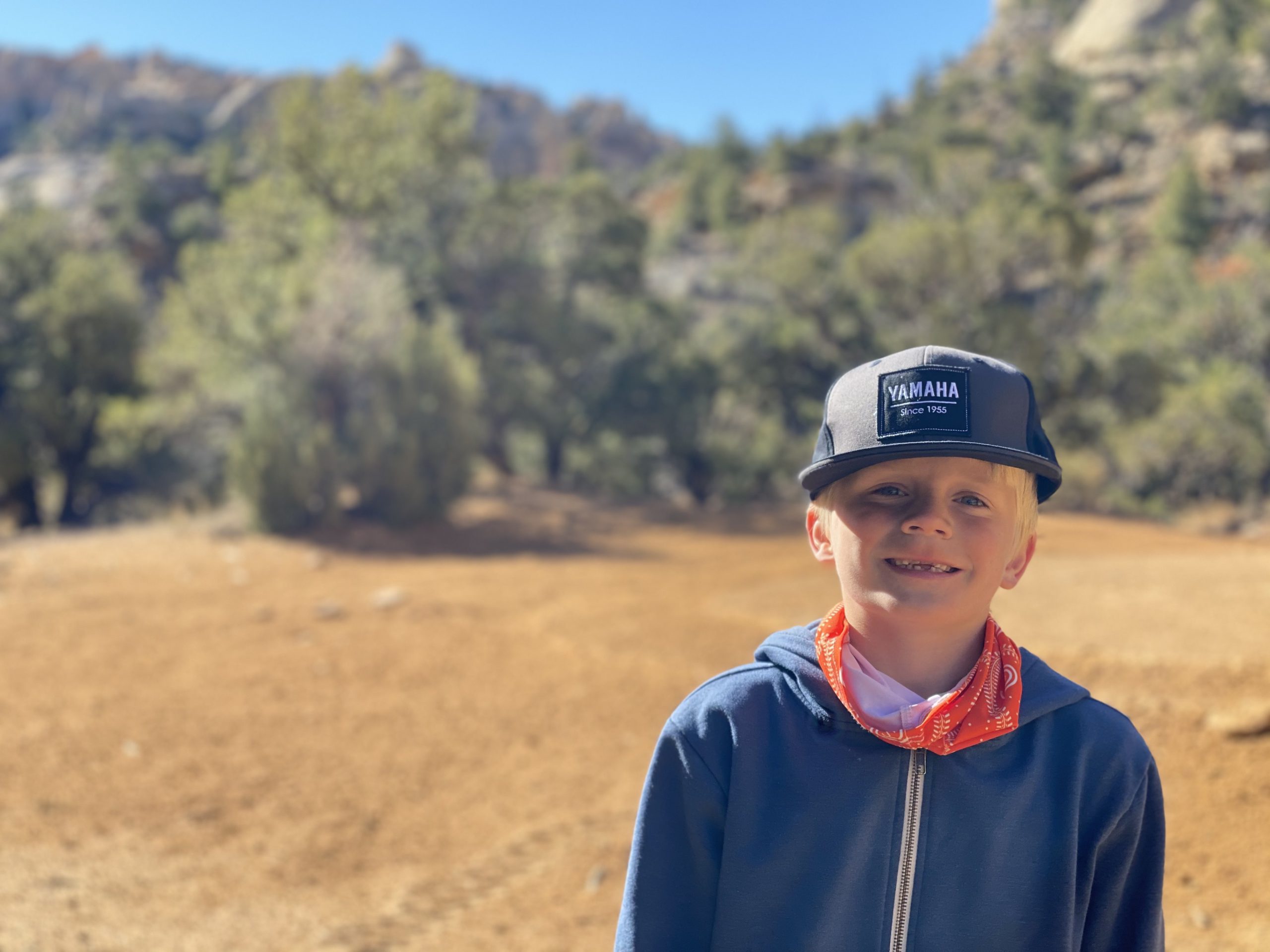
This route report is part of a larger guidebook BRC is completing to educate users about high-value motorized trails that are at risk of closure if we don’t use them. This guidebook will be called the Lost Trails Guidebook, and has been funded by a generous grant from the Yamaha Outdoor Access Initiative with Jorgensens Powersports as a sponsoring dealer

Continue reading...
Getting There: SS4121 leads off of SS4115, just south of the main network of trails running across the Family Butte Mesa. There are two primary routes that lead to this area (though many others could be selected to fit you and your group within the many existing trails of the San Rafael Swell). For those looking for the most direct route along an easy, open road, we recommend traveling south along BLM Route SS4001 to SS4002 from I-70 (see picture below on the left). For those looking for a more scenic, exploratory route, we recommend taking Eagle Canyon from Justensen Flats to BLM Route SS4059 (see picture below on the right).
Route Conditions: BLM Route SS4002 is an easy, broad route, located adjacent to Family Butte Road. This route is passable for any high clearance, 4WD vehicle during most seasons of the year. Eagle Canyon to BLM route 4059 features more rugged, technical terrain and access to a plethora of routes and spurs located throughout the San Rafael Swell. We recommend using a well equipped, high clearance 4WD or AWD vehicle, should you take the second route.
Take time to familiarize yourself with the map and coordinates and plan a route that best fits you and your group. Be sure to not head off into the backcountry alone and tell someone where you are going before starting your trip. As always, utilize LEAVE NO TRACE practices. Irresponsible recreation leads to ecological damage, road closures, and loss of access to important resources. It is important that motorized users stay on the trail and camp within a 30′ buffer zone on either side of the road.
BLM Route SS4121 turns off from SS4115 at GPS coordinates 38°46’51.97″N and 110°50’36.17″W. The trail extends for approximately 0.05 miles before reaching the edge of a large drop off. The trail lines the edge of a vibrant overlook and is dotted with several spectacular dispersed campsites (as pictured above). This area contains five of the areas best dispersed campsites located within the San Rafael Swell. Due to the trail configuration, you can camp along the entire ridgeline. You will find these dispersed campsites at GPS coordinates 38°46’49.75″N and 110°50’34.74″W.
This route report is part of a larger guidebook BRC is completing to educate users about high-value motorized trails that are at risk of closure if we don’t use them. This guidebook will be called the Lost Trails Guidebook, and has been funded by a generous grant from the Yamaha Outdoor Access Initiative with Jorgensens Powersports as a sponsoring dealer
Continue reading...