Overview: Utah’s San Rafael Swell is home to some of the most spectacular deserts trails of the Intermountain West. Within its the vast network of trails, the Family Butte area covers a broad mesa that overlooks much of the desert. This area is home to breathtaking sandstone cliffs and remote landscapes. Many of the trails in the Family Butte area lead to hidden adventure destinations, including dispersed campsites, abandoned mines, and other remote gems. The NW Family Butte Spur (also known as BLM Route SS4071), along with its companion spur (BLM Route 4072), is a must see for any adventurer on the lookout for dramatic overlooks, rugged off-roading terrain, and an undisturbed, out-of-the-way experience.
Getting There: There are several ways to approach this spur within the many existing trails of the San Rafael Swell. Take time to familiarize yourself with the map and coordinates and plan a route that best fits you and your group. Be sure to not head off into the backcountry alone and tell someone where you are going before starting your trip.
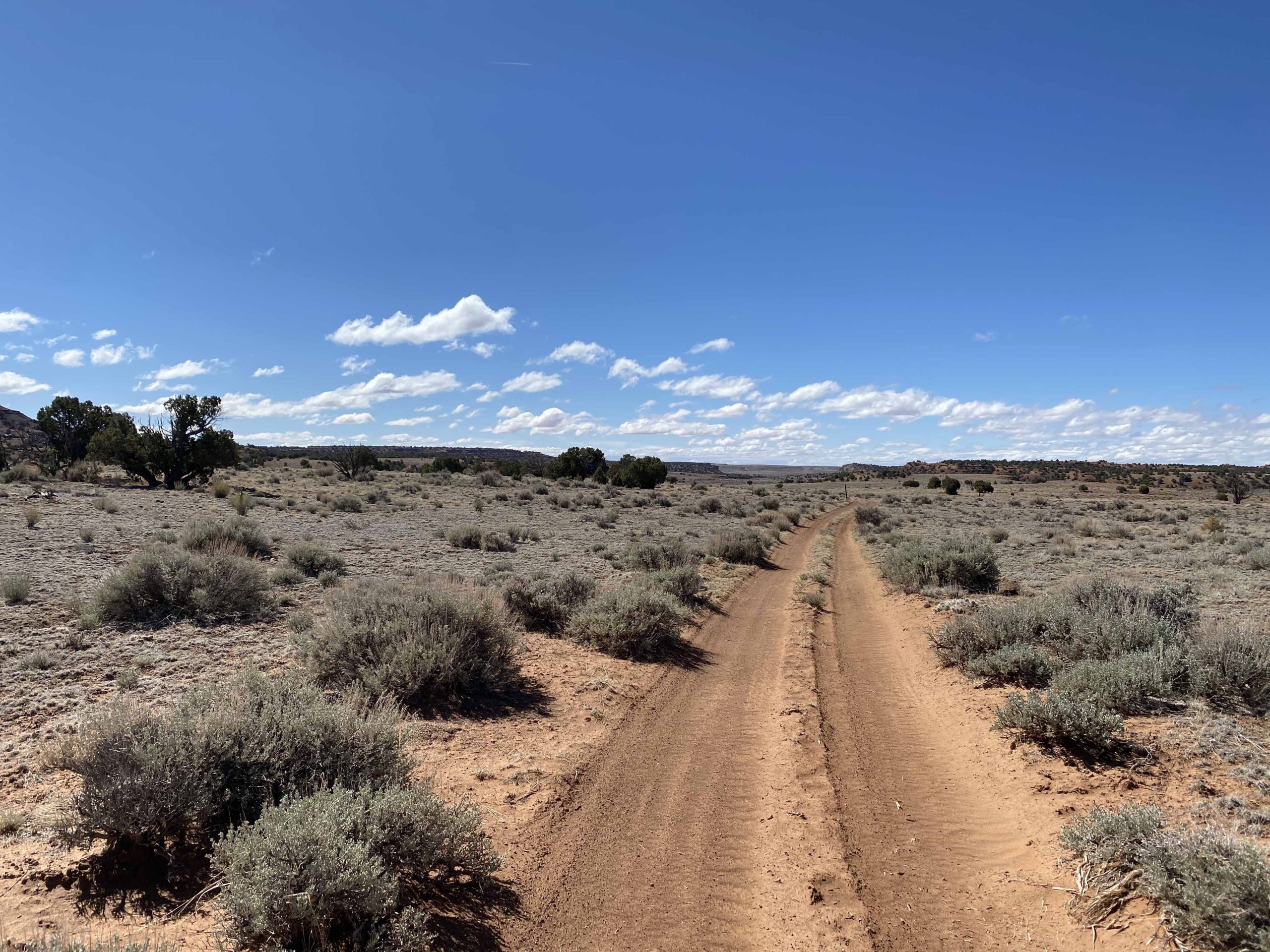
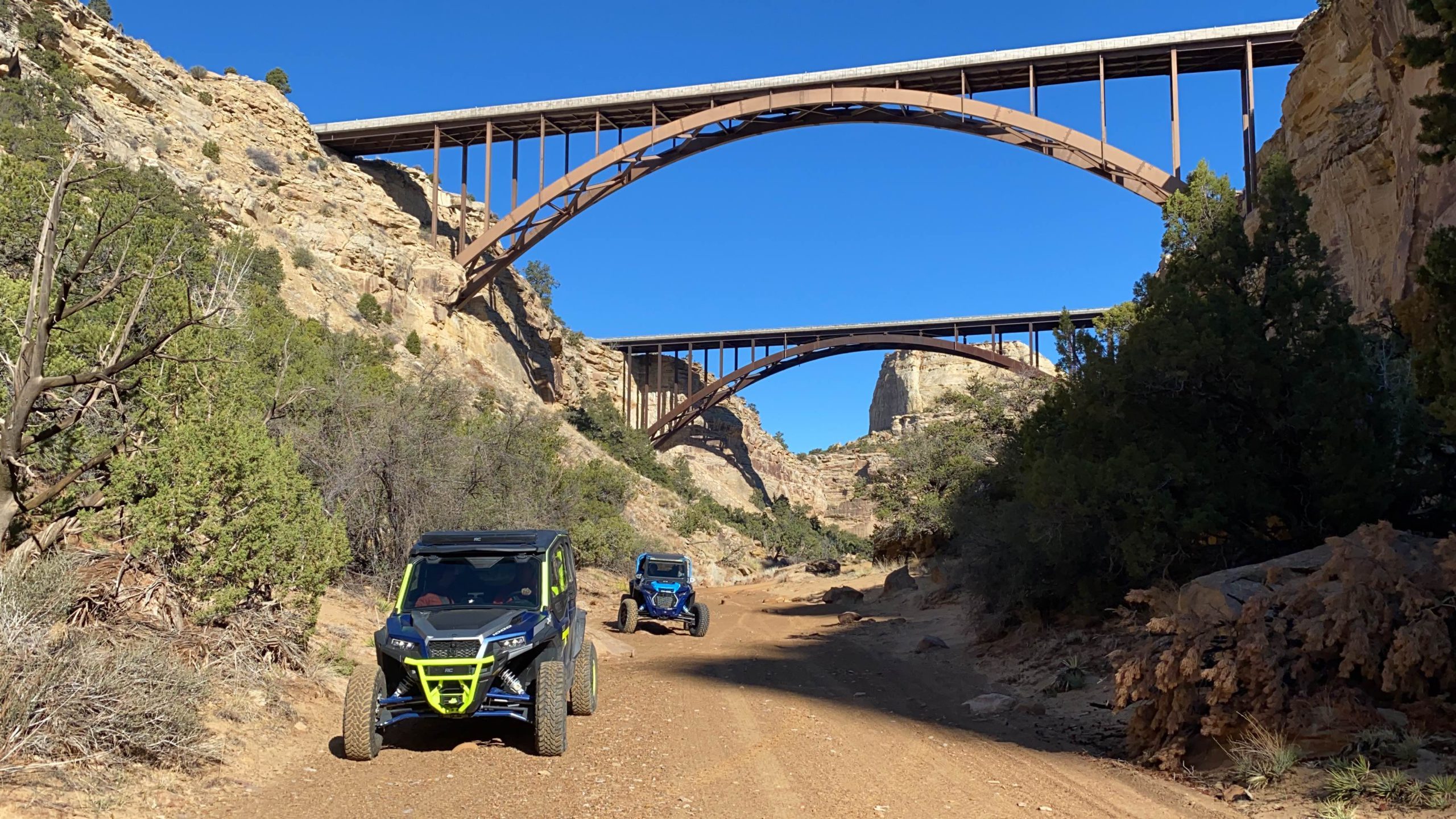
There are two primary routes that lead to the Family Butte area (many others could be selected to fit you and your group within the many existing trails of the San Rafael Swell). For those looking for the most direct route along an easy, open road, we recommend traveling south along BLM Route SS4001 to SS4002 from I-70 (see picture below on the left). For those looking for a more scenic, exploratory route, we recommend taking Eagle Canyon from Justensen Flats to BLM Route SS4059 (see picture below on the right).
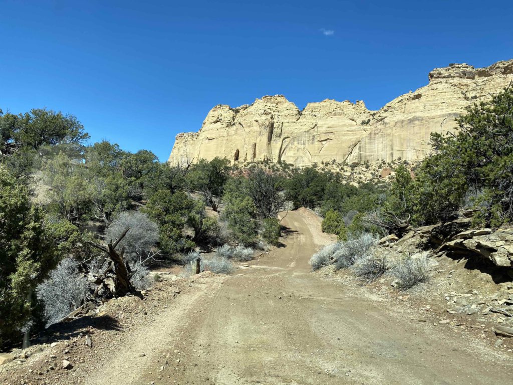
Route Conditions: BLM Route SS4002 is an easy, broad route, located adjacent to Family Butte Road. This route is passable for any high clearance, 4WD vehicle during most seasons of the year. Eagle Canyon to BLM route 4059 features more rugged, technical terrain and access to a plethora of routes and spurs located throughout the San Rafael Desert. We recommend using a well equipped, high clearance 4WD or AWD vehicle and being mindful of weather conditions, should you take the second route.
As always, follow LEAVE NO TRACE practices. It is important that motorized users stay on the trail and camp within a 30′ buffer zone on either side of the road. Irresponsible recreation leads to ecological damage, road closures, and loss of access to important resources.
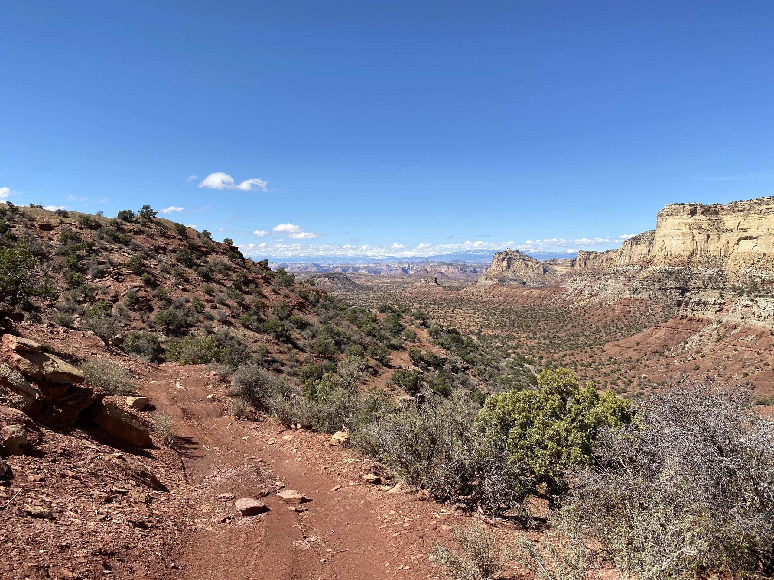
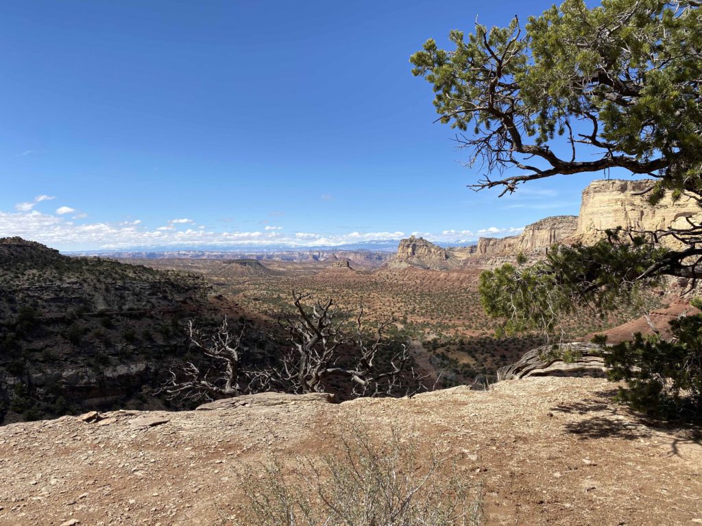
The NW Family Butte Spur (BLM Route SS4071) turns off of BLM Route SS4060 at coordinates 38°47’57.71″N and 110°50’25.59″W. Route SS4071’s companion spur, BLM Route SS4072, turns off of the NW Family Butte Spur just over a quarter of a mile up the trail. The NW Family Butte Spur curves off along the cliffs toward the southwest, turning into BLM SS4073. BLM Route SS4072 continues for about another quarter mile before ending at an ideally remote dispersed campsite (see picture above on the right).
These and other nearby spurs discussed in this article are at risk of closure under claims of natural reclamation if they are not used. Please come and enjoy this beautiful area and help to keep our roads open.


This route report is part of a larger guidebook BRC is completing to educate users about high-value motorized trails that are at risk of closure if we don’t use them. This guidebook will be called the Lost Trails Guidebook, and has been funded by a generous grant from the Yamaha Outdoor Access Initiative with Jorgensen Powersports as a sponsoring dealer.

Continue reading...
Getting There: There are several ways to approach this spur within the many existing trails of the San Rafael Swell. Take time to familiarize yourself with the map and coordinates and plan a route that best fits you and your group. Be sure to not head off into the backcountry alone and tell someone where you are going before starting your trip.
There are two primary routes that lead to the Family Butte area (many others could be selected to fit you and your group within the many existing trails of the San Rafael Swell). For those looking for the most direct route along an easy, open road, we recommend traveling south along BLM Route SS4001 to SS4002 from I-70 (see picture below on the left). For those looking for a more scenic, exploratory route, we recommend taking Eagle Canyon from Justensen Flats to BLM Route SS4059 (see picture below on the right).
Route Conditions: BLM Route SS4002 is an easy, broad route, located adjacent to Family Butte Road. This route is passable for any high clearance, 4WD vehicle during most seasons of the year. Eagle Canyon to BLM route 4059 features more rugged, technical terrain and access to a plethora of routes and spurs located throughout the San Rafael Desert. We recommend using a well equipped, high clearance 4WD or AWD vehicle and being mindful of weather conditions, should you take the second route.
As always, follow LEAVE NO TRACE practices. It is important that motorized users stay on the trail and camp within a 30′ buffer zone on either side of the road. Irresponsible recreation leads to ecological damage, road closures, and loss of access to important resources.
The NW Family Butte Spur (BLM Route SS4071) turns off of BLM Route SS4060 at coordinates 38°47’57.71″N and 110°50’25.59″W. Route SS4071’s companion spur, BLM Route SS4072, turns off of the NW Family Butte Spur just over a quarter of a mile up the trail. The NW Family Butte Spur curves off along the cliffs toward the southwest, turning into BLM SS4073. BLM Route SS4072 continues for about another quarter mile before ending at an ideally remote dispersed campsite (see picture above on the right).
These and other nearby spurs discussed in this article are at risk of closure under claims of natural reclamation if they are not used. Please come and enjoy this beautiful area and help to keep our roads open.
This route report is part of a larger guidebook BRC is completing to educate users about high-value motorized trails that are at risk of closure if we don’t use them. This guidebook will be called the Lost Trails Guidebook, and has been funded by a generous grant from the Yamaha Outdoor Access Initiative with Jorgensen Powersports as a sponsoring dealer.
Continue reading...