The Manti-La Sal National Forest has submitted a Revised Forest Management Plan. The forest is more than 1.4 million acres and spans from San Juan County, to Utah County. If you recreate in Southern or Central Utah, chances are you have come in contact with the Manti-La Sal National Forest.
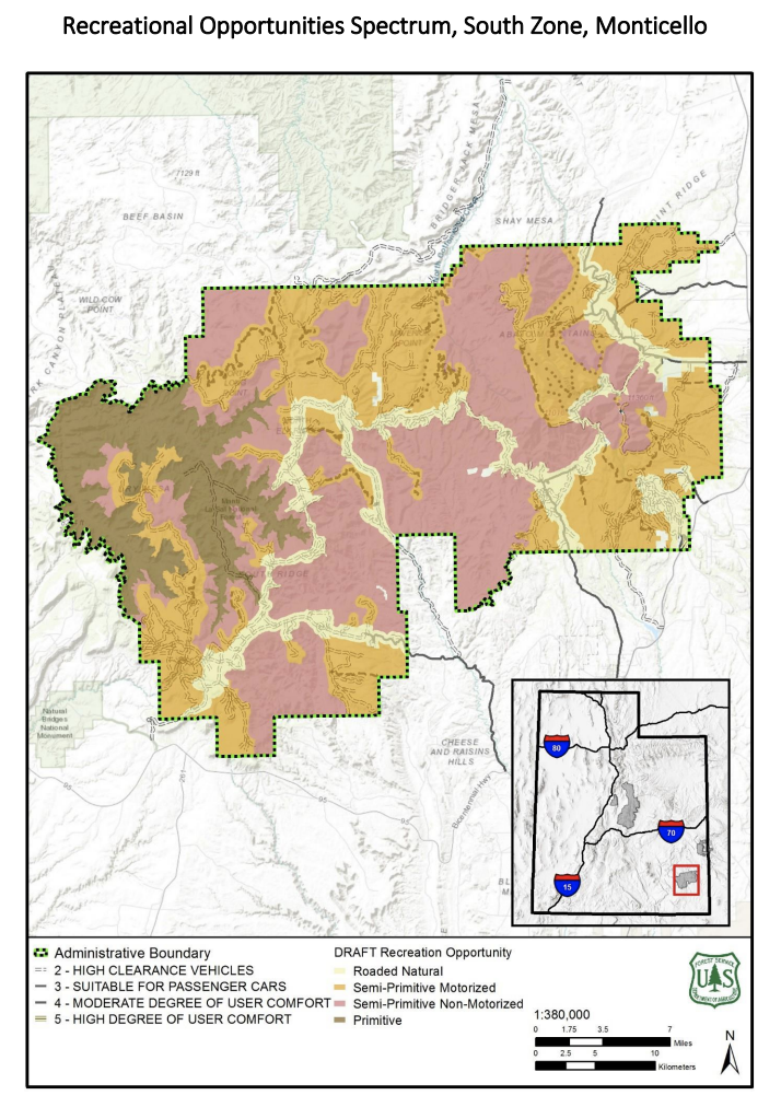
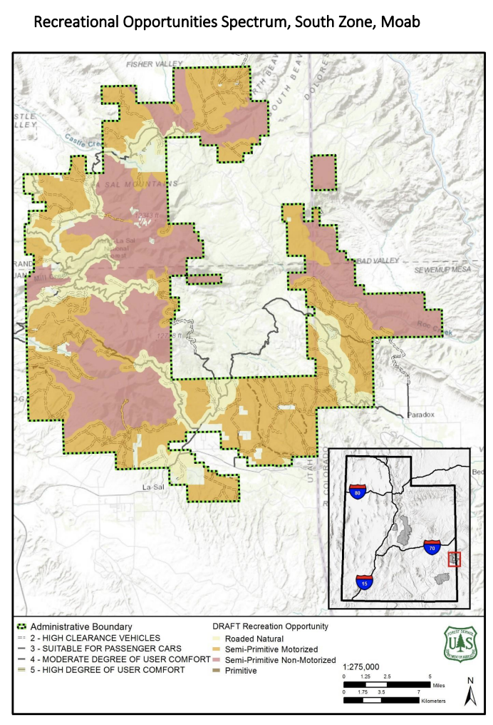
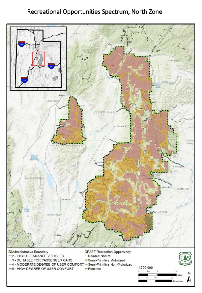
The plan highlights different types of designations with various degrees of restrictions. The green and pink areas that you see in the map will have all existing roads and trails closed. This is a very large area and we are concerned with the amount of access that will be taken away from users. From Arch Canyon, to the Arapeen Trail, to the towering peaks of the La Sals, to some of the best snowmobiling terrain in Utah, this plan will impact a wide range of recreation users.
As you can see, these areas cover a large portion of the forest.
We have been analyzing this plan, and we have prepared some initial comment language you can use to protect our access in this huge area of Utah. Fill out the form below to submit a comment to the Forest Service.

Continue reading...
The plan highlights different types of designations with various degrees of restrictions. The green and pink areas that you see in the map will have all existing roads and trails closed. This is a very large area and we are concerned with the amount of access that will be taken away from users. From Arch Canyon, to the Arapeen Trail, to the towering peaks of the La Sals, to some of the best snowmobiling terrain in Utah, this plan will impact a wide range of recreation users.
As you can see, these areas cover a large portion of the forest.
We have been analyzing this plan, and we have prepared some initial comment language you can use to protect our access in this huge area of Utah. Fill out the form below to submit a comment to the Forest Service.
Continue reading...